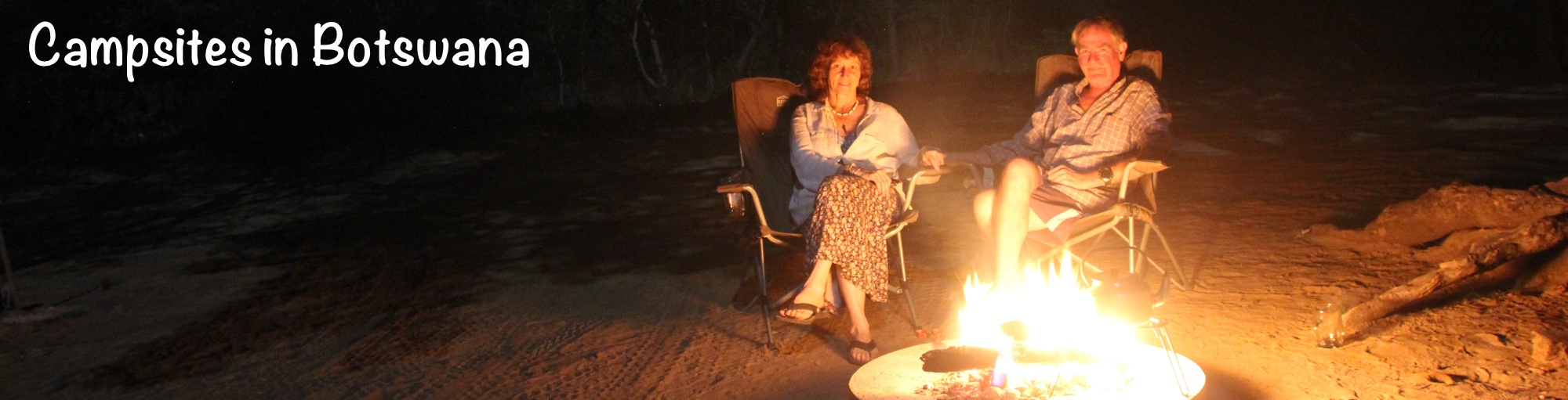
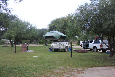
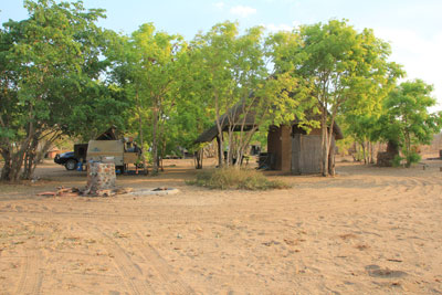
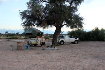
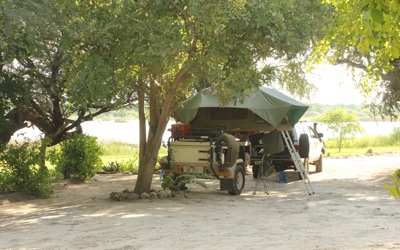
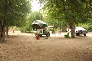
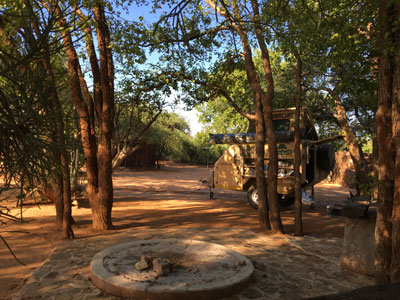
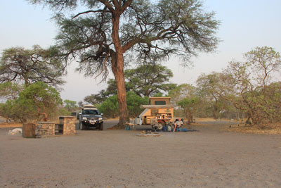
We love camping in Botswana. The Park campsites are often expensive but, for the most part, they are well spread out so you have plenty of space. There are no fences around the campsites so you need to be aware that animals can walk into your camp. On getting up in the morning we usually start by examining tracks to see what animals have been around during the night.
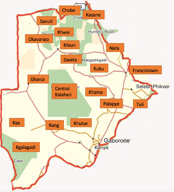
The map shows the campsites that we've used in Botswana over the past few years. Below the map is information about them, listed in alphabetical order. You can click on the places on the map or scroll down the page. Because of the campsite links the map image will not change size on different devices.
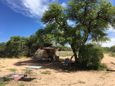
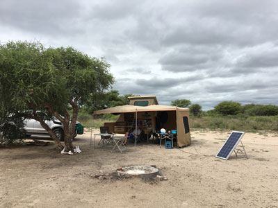
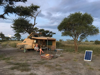
I have included the prices we paid on sites we've visited recently.
Botswana National Parks.
Booking campsites in the Parks can be pain as camps are run by different organizations. A few are still run by DWNP (Department of Wildlife and National Parks) but several private companies manage many of the camps.
During high season (May to October) you are likely to need to book a year in advance.
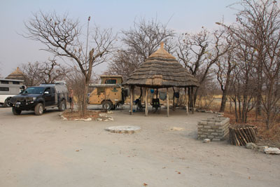
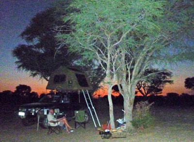
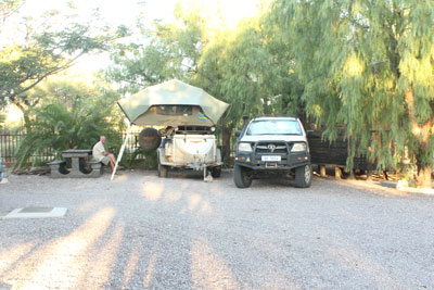
Campsite Information
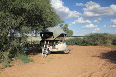
Central Kalahari. 1 - Sunday Pan
Last visited: Feb 2012
Location: S21 19.899 E23 41.287
Contact: www.bigfoottours.co.bw/general_page.html#camp_info
Ablutions: Pit latrine and bucket shower (you need to provide your own water).
Electric: No.
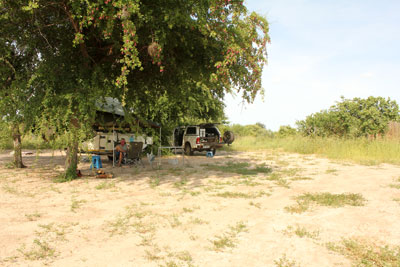
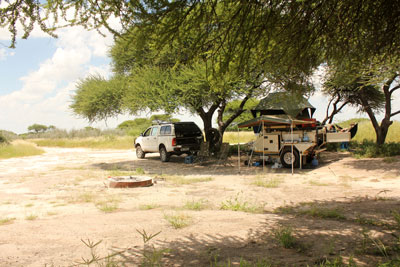
Site: we stayed at site 1. Good shade. Site 2 is nearby but not too close.
Other: Less than 1km to drive to the Sunday Pan waterhole where we have always seen animals.
Central Kalahari. 2 - Kori
Last visited: Feb 2012
Location: S21 25.391 E23 47.747
Contact: Department of Wildlife & National Parks.
Ablutions: Pit latrine and bucket shower (you need to provide your own water).
Electric: No.
Sites: We staayed at site 2. Good shade. The sites are spread out and are next to Deception Valley.
Chobe National Park. Ihaha camp

Last visited: March 2018
Location: S17° 50' 21.2" E24° 52' 43.0"
Contact: www.kwalatesafaris.com
Cost: Expensive. I think it was US$ 40 per person per day to camp for internationals, plus the daily park fees.
Ablutions: There are 2 ablution blocks. The one we used was OK with hot showers but rather run down.
Electric: No.
Sites: There are 10 sites alongside the river channel which might have water depending on the time of year. We stayed at site 9 which had a large shady tree and a good view of the river which, in March, was right next to the campsite. A guy came round in a bakkie offering wood which you could order.
Other: As we went towards the end of the wet season we expected the animals to be all over the park, however they were mostly close to the river. We saw elephants every day from our campsite and, one day, they passed in front and behind our site so driving to the ablutions is sometimes the best option. Ihaha is a very popular campsite and during the dry season you are likely to have to book well in advance. In March we were able to book in at the gate but they only accept cash in Pula or US$.
Francistown. Woodlands Stopover
Last visited: July 2012
Location: About 20km from Francistown on the Nata road. S21 04.894 E27 27.842
Contact: www.woodlandsbotswana.com
Ablutions: Spotless. Hot showers.
Electric: Yes.
Sites: The grassy pitches are quite small but fine for a night. All have a braai and electric point and some also have a fire base and a drinking water tap.
Ghanzi. Thakadu Bush Camp

Last visited: March 2012
Location: A few kilometres south of Ghanzi. S21 44.316 E21 40.880
Contact: www.thakadubushcamp.com.
Ablutions: Clean. Hot water & showers.
Electric: Yes.
Sites: Large shady pitches each with power, drinking water, braai and a bin.
Gweta. Planet Baobab
Last visited: Sept 2013
Location: S20 11 21.6 E25 18 20.6
Contact: planetbaobab.travel
Ablutions: Clean. Hot water.
Electric: Yes.
Sites: There are 6 sites for independent travellers which are separate to the sites for overland trucks. Each site has a shaded area, braai, fire base and electric point.
Kaa Concession. Masetleng Pan
Last visited: Oct 2010
Location: S23 42.342 E20 53.907
Contact: You need to pay at either Ngwatle or Ukhwi villages. At Ukhwi there were people on the track through the village who we paid and got a receipt. At Ngwatle(on our 2nd visit) we tried to find the chief's hut (no-one had any English) and when we eventually found it they couldn't find the receipt book so we weren't charged.
Ablutions: None.
Electric: No.
Sites: Just one site overlooking a large pan.
Kang. Kang Ultra Stop.
Last visited: March 2012
Location: On the Trans Kalahari Highway S23 40 54.7 E22 46 00.3
Contact: kangultrastop.com
Ablutions: Clean, Hot water & showers.
Electric: Yes.
Sites: The campsite was closed for rebuilding (March 2012) but we were able to stay on the gravel in the wooden chalets area.
Kasane. 1 - Chobe River Lodge
no photo
Last visited: Nov 2011
Location: On the southern edge of Kasane next to the Chobe River. S17 48.517 E25 08.740
Contact: www.chobe-safari-lodge.net
Ablutions: Clean. Hot showers.
Electric: Yes.
Sites: There are lots of small marked pitches under shady trees.
Other: There's likely to be a few large overlander's trucks but we've never found it too noisy. There's a walkway to the Lodge where there's a pool, bar and restaurant. The sunset cruises from the Lodge are excellent.
Kasane. 2 - Senyati Safari Camp
Last visited: March 2018
Location: 15km from Kasane on the road to Nata. S17 52.362 E25 14.138
Contact: senyatisafaricampbotswana.com
Ablutions: Your own personal shower, toilet and kitchen area. Hot water from a donkey boiler.
Electric: Yes.
Sites: Several shady sites. All sites have a shade structure, private ablutions, a braai and fire base. A guy will light the donkey boiler for you in the morning and again in the afternoon.
Other: If you like the bush then this is undoubtedly the best campsite in the Kasane area. The site is in the Lesoma Valley and the waterhole with a fresh water outlet is a favourite with elephants but you're likely to see other animals as well. We saw roan antelope, sable, giraffe, impala, kudu and warthog. There's a great view of the waterhole from the raised bar area and a different perspective from the underground bunker. There's a fenced swimming pool.You can buy firewood at reception.Free wifi from 5pm to 9pm round the deck area. Day trips to Vic Falls, Sunset cruises and game drives can be organised at reception. Half price from the middle of January to the middle of March. Chalets are also available.
Khutse Game Reserve. 1- Moreswe
Last visited: Feb 2018
Location: S23° 33' 43.1" E24° 05' 48.7"
Contact: www.bigfoottours.co.bw
Ablutions: Pit latrine. Bucket shower but the shower rose and tap had broken.
Electric: No.
Site: We stayed at site 2. Good shade.There's a bit of a view of the Pan which probably makes this the best site (the others have no view at all).
Other: A lovely quiet camp but quite a long drive from the entrance gate. You can drive around the Pan and along a track and around another nearby Pan.
Khutse Game Reserve. 2 - Molose
Last visited: Feb 2018
Location: S23° 23' 03.4" E24° 11' 12.7"
Contact: www.bigfoottours.co.bw
Ablutions: Pit latrine. Bucket shower - there was no rose but the tap did work
Electric: No.
Site: Site 1 : Nowhere to drive except along the main track and the short tracks around the waterhole. There's no Pan so you can't see very far. Probably a good site in the dry season when animals are dependent on the waterhole.
Other: There's a bar, restaurant and pool. Activites include walking trails, Bushman Walks and Bushman Dances.
Khutse Game Reserve. 3 - Khutse
Last visited: Feb 2018
Location: S23° 20' 20.8" E24° 30' 05.7"
Contact: www.bigfoottours.co.bw
Ablutions: Pit latrine - and a shower that worked.
Electric: No.
Sites: There are 10 sites which are the ones closest to the Entrance Gate but in February we were the only people there. Some have shade.
Kgalagadi Transfrontier Park (KTP) 1 - Mpayathutlwa
Last visited: March 2012
Location: S25 03.676 E21 58.990
Contact: Department of Wildlife & National Parks.
Ablutions: Pit latrine. Shower (cold water).
Electric: No.
Site: Site 1 has a lovely location with excellent shade overlooking the Pan. You can just see the waterhole from the edge of the site.
Other: This is one of the most popular sites in this part of the Park as it overlooks a pan with a permanent waterhole which is popular with game. We've always heard (but not always seen!) lion in this area.
KTP. 2 - Lesholoago
Last visited: March 2012
Location: S24 56.424 E22 03.477
Contact: Department of Wildlife & National Parks.
Ablutions: Pit latrine. Shower (cold water).
Electric: No.
Site: Site 1. A lovely location with some shade overlooking the Pan.
Khama Rhino Sanctuary
Last visited: April 2016
Location: A few kilometres south of Ghanzi. S21 44.316 E21 40.880
Contact: Khama Rhino Sanctuary
Cost: Campsite: P102.85 pppn. Park fees: P78.65 pppd plus P284.35 per vehicle per day. Credit cards accepted.
Ablutions: There are 2 ablution blocks. Clean. Hot water from an electric geyser.
Electric: Not at the sites. There's a plug point in the ablutions.
Sites: There are 13 large unfenced campsites spread out in the bush a few kilometres from the entrance gate. Each site has a braai, fire base, cold water tap, bin and shade from large Mokongwa trees.
Other: The Reserve was set up as a safe breeding location for white rhino. There are self-drive tracks around the reserve, you can buy a map from the shop at the entrance which also sells wood, curios, cold drinks and snacks. The tracks in the Park are sandy. We didn't lower the tyre pressures and managed fine in high 4 wheel drive.
Kubu Island

Last visited: Sept 2013
Location: S20 53 27.6 E25 49 19.1
Contact: www.kubuisland.com
Cost: P152 pppn.
Ablutions: Each site has a rather smelly longdrop toilet.
Electric: No.
Sites: Large sites on the northern and western side of the island. Some have shade.
Other: There's no water so take all you need. You need a 4x4 to get to Kubu Island and it's only accessible during the dry season. It's 45 km of stony / sandy / dusty tracks from the south and 100km and lots of dust from Gweta or Nata! That said it's pretty amazing driving across the Pans and having a look around the island which has large rocks and huge baobab trees in the middle of a huge pan.
Khwai Development Trust. Magotha Camp
Last visited: Sept 2013
Location: S19 06 28.8 E23 51 46.5
Contact: www.khwaitrust.co.bw
Cost: P290 pppn.
Ablutions: None
Electric: No.
Sites: There are 15 sites of which numbers 1,2,3,4 and 15 overlook the Khwai River. We stayed at site 1.
Other: You must book before you go. If you travel via Moremi / Khwai North gate then call in at the village to show your reservation. If coming from the Savuti direction then camp wherever you want and show your reservation when the village guys come around. If you want to visit Moremi them you'll need to have paid for day permits in advance. You'll need a 4x4 with low range to get around the area. There are several river crossings, best to watch or ask other campers before crossing as there are some deep holes - and crocs and hippos in the river. We saw lots of game in the vicinity of the river during the dry season.
Maun. 1 - Drifters Lodge
Last visited: Feb 2012
Location: 35km East of Maun. S20 10.280 E23 40.398.
Contact: www.drifters.co.za/tours-and-lodges/drifters-maun-lodge/
Ablutions: Clean. Hot water & showers.
Electric: Provided by a generator from 6 - 10pm. You'll need a long cable.
Sites: Lovely grassy sites next to the Boteli River
Other: There's a bar & pool. Used by Drifters Tours a couple of nights each week.
Maun. 2 - Sedia Hotel campsite
Last visited: Sept 2013
Location: 6km north of Maun S19 57 10.4 E23 28 41.9
Contact: sedia-hotel.com
Ablutions: One ablutions block for the site. Clean. Hot water & showers.
Electric: There are several power points around the site.
Sites: No marked sites, just pitch wherever you want. There are plenty of bushes and a few large trees for shade. The overland trucks tend to use the open area between the ablutions and the hotel.
Nata. 1 - Elephant Sands
Last visited: March 2018
Location: About 50km north of Nata. S19° 44' 56.7" E26° 04' 16.2"
Contact: www.elephantsands.com
Ablutions: 1 ablutions block which was clean with hot water.
Electric: No.
Sites: An open site (no shade at all) with a few sites overlooking the waterhole which is frequented by elephants, although we didn't see any in March.
Other: There's a bar, restaurant and pool. There are now lots of chalets almost all the way around the waterhole. The campsite is very popular with overland groups - apart from during the rainy season when it's almost empty.
Nata. 2 - Pelican Lodge
Last visited: March 2018
Location: Just south of Nata. S20° 13' 04.6" E26° 14' 01.4"
Contact: www.thewildlodges.com/pelican.html
Cost: P100 pppn. Cards accepted.
Ablutions: Each site has its own ablutions with plenty of hot water.
Electric: Yes.
Sites: There are 3 sites at the back of the Lodge. One has good shade. The water is OK for drinking.
Okavango Panhandle. 1 - Shakawe Fishing Lodge

Last visited: Feb 2012
Location: S21 19.899 E23 41.287
Contact: shakawelodge.com
Ablutions: Clean. Hot water & showers.
Electric: Yes.
Sites: Great sites beside the Okavango River.
Other: The campsite (and chalets) were being refurbished - new owners took over in 2011. If you like birding then ask to be taken round the nearby woodland where there are pel's fishing owls.
Okavango Panhandle. 2 - Tsodilo Hills
Last visited: Feb 2012
Location: Tsodilo Hills World Heritage Site. S18 45.571 E21 44.192
Contact:
Ablutions: Hot water and showers.
Electric: Yes from the main building but you'll need a long cable.
Sites: We camped in the area close to the museum. There are a couple of other places to camp but they have no facilities.
Palapye. Camp Itumela
Last visited: March 2018
Location: S22° 33' 34.6" E27° 07' 39.4"
Contact: www.campitumela.com
Cost: P90 pppn
Ablutions: They were clean but the electric showers were either cold or too hot!
Electric: There were a few electric points (not all working) dotted around.
Sites: Several sites (not marked) most with some shade. Some had fire pits and/or braai facilities.
Savuti Camp, Chobe National Park.
Last visited: Sept 2013
Location: S19 57 10.4 E23 28 41.9
Contact: sklcamps.com/campsavuti
Ablutions: One central ablutions block protected from the elephants by a big earth wall. Clean. Hot water.
Electric: No.
Sites: Most sites have a braai and fire base and are situated under shady trees. We like sites 1, 2, 3 and 4 best as they overlook the Savuti Channel which, in Sept 2013, still had plenty of water in it.
Other: Currently the only place where you can cross the Channel is by the bridge next to the Rest Camp. During the dry season none of the waterholes away from the Channel had any water in them so the best animal viewing is within a km or so of the Channel. Several loop roads marked on the map aren't passable because of the mud/water.
Tuli Block. 1 - Limpopo RIver Lodge

Last visited: April 2016
Location: S22 29 42.4 E28 47 37.9
Contact: limpoporiverlodge.co.za
Cost: P122.00 / R183.00 per person per night.
Ablutions: Shower, flushing toilet and sink with hot water from a donkey boiler or solar water heater. Toilet paper not provided.
Electric: No.
Sites: Good sized sites. All have good shade and are on the banks of the Limpopo. Each site has a braai, ground fireplace, cold water tap (not drinking water) and, behind the site, private ablutions. Firewood is provided.
Other: We saw plenty of birds at the site and it was lovely sitting by the river. We only had a couple of nights there and would certainly spend longer there on another trip. You can drive around the Reserve.
Tuli Black. 2 - Molema Bush Camp

Last visited: April 2018
Location: S22 17 57.7 E28 58 29.5
Contact: www.tulitrails.com
Cost: R300 per person per night.
Ablutions: Rustic. Each site has a shower, flushing toilet and sink with hot water from a gas geyser. The gas geysers on sites 1 and 2 are in need of some attention
Electric: No.
Sites: 4 large sites under huge shady trees. Each site has a braai, ground fireplace, shower, toilet, sink and water tap (not drinking water).
Other: Baboons and vervet monkeys are around and will steal any food left out. You cannot self drive in the Reserve. Morning and afternoon drives (R300 pp) and bush walks (R275pp) are available. We did a bush walk and morning and afternoon drives and found the guide informative. It a short walk through quite thick bush to the Limpopo RIver.