South Africa
Southern Africa
UK
Campsites (Africa)
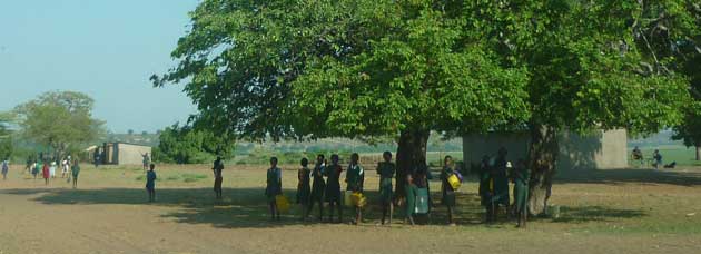
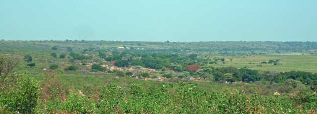
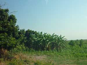
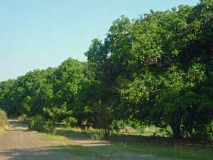
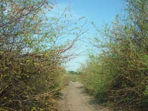
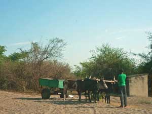
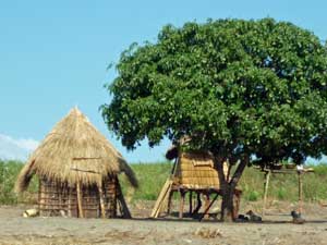
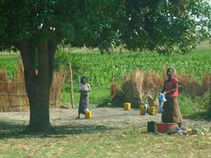
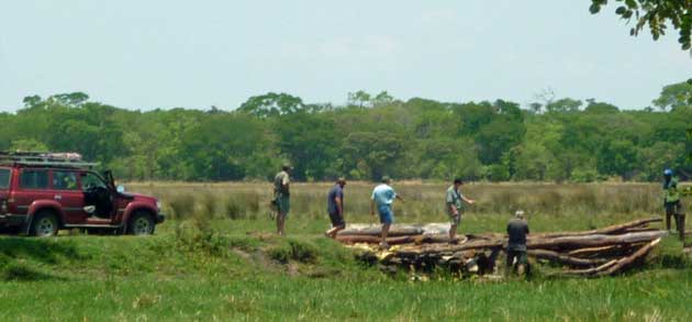
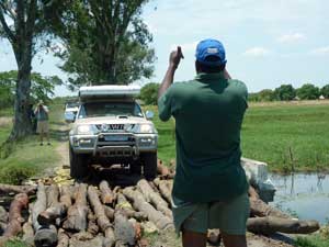
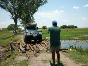
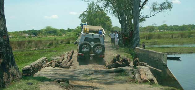
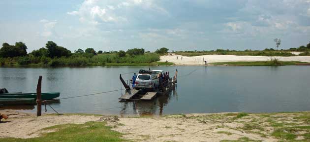
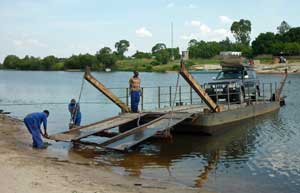
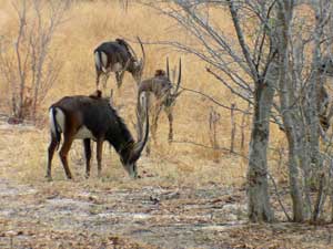
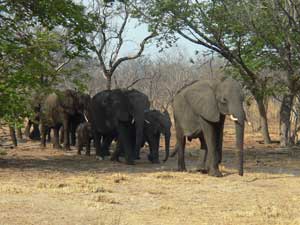
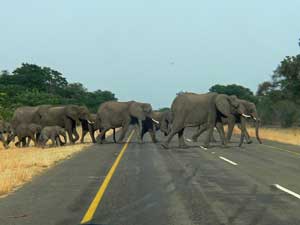
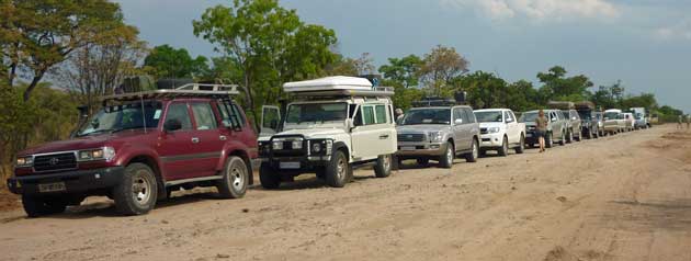
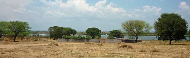
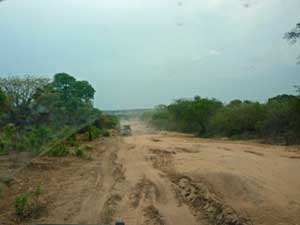
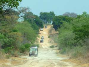
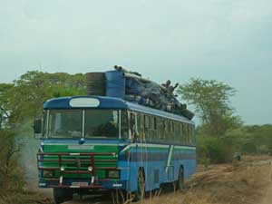
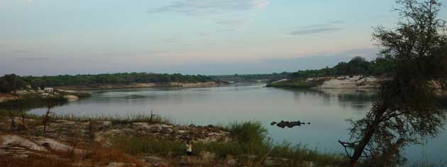
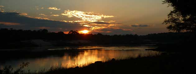
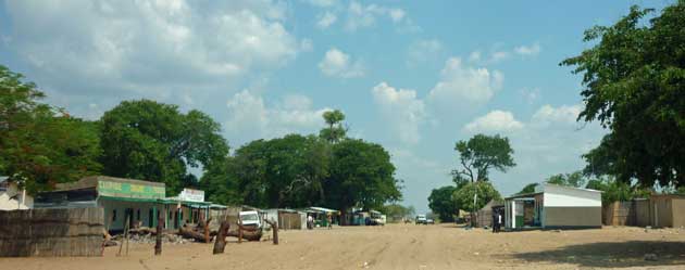
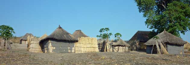
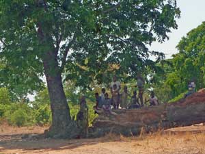
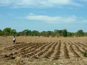
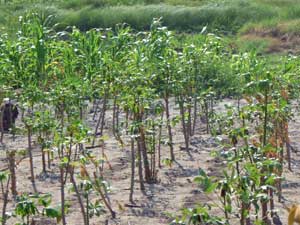
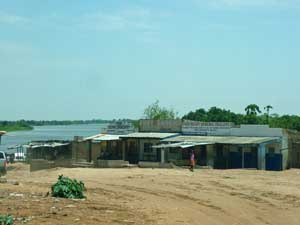
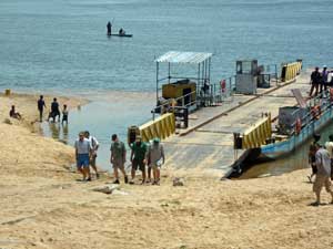
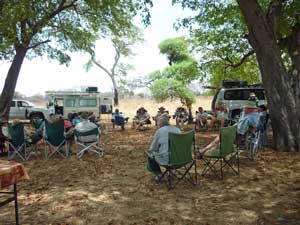
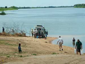
We left Kasane and followed the tar road through Chobe National Park to the Namibian border. We were lucky enough to see a large group of beautiful sable antelope. Later a group of elephants suddenly appeared and crossed the road in front of us - just as well we were keeping within the Park speed limit of 50km/hr. We drove to Katima Mulilo in Namibia, where we filled up with fuel and also had to pay the road tax duty of N$200 (nearly £20) even though we were only spending a couple of hours in transit from Botswana to Zambia. Our route to Liuwa Plains: The Zambian border crossing, as Vick had told us, was very different from those in Botswana and Namibia. We had to go to 5 different ‘offices’. We started with the passport control (US$100 for our visas) and then went to the Revenue Authority office (which was air conditioned but very small) where we had to fill in another form and pay R250 for our vehicle. Next was a visit to a nearby portacabin where we paid US$20 for road tax then onto a wooden shed to pay R300 for 3rd party insurance and finally to a broken down caravan where we paid R50 for the local council tax. It took us the best part of an hour. Once everyone was through we all met up and continued in a convoy. We didn't drive too close together because of the dust. We'd been given 2-way radios this morning so Vick was able to advise us about obstructions, goats etc on the road. From time to time we could see the Zambezi RIver on our right and there were often small settlements near the river. We saw very few other vehicles but did pass this heavily laden bus.... The Zambezi River at Sioma Camp (S16 42.381 E23 38.470). Sunrise over the Zambezi River. As we headed north alongside the Zambezi we started to see more villages as the river valley got wider. Many of the houses were made of reeds and/or mud walls with thatched roofs. As we passed some of the children would run down towards us asking for ‘sweeeeeeets’. Vic had asked us not to give them anything as it only encourages them to beg and, as we discovered in Mozambique, they can become almost aggressive if you don’t stop (since that experience we’ve never given children anything). In fact I think all the guide books also state that you shouldn’t give them anything – better to give to a proper charity. The staple diet in this region is cassava and we saw it in various stages of growth. The soil is very sandy so there is a culture of 'slash and burn' - clearing a new piece of ground rather than reuse the same soil which has resulted in the destruction of large areas of woodland. Making planting holes for the cassava. Cassava plants. Kalangola (S16 14.574 E23 14.354), where the road crosses the river, was the biggest village that we'd seen so far in Zambia. There were several shops many of them selling dried fish as well as sweets and soft drinks (but not cold ones!). However we discovered that the ferry had broken down. Several of the guys went to see if they could help but they weren't able to and were told that it might be ready in 2 or 3 hours time. We retraced our route and found some shady trees to sit under for lunch. Vic said that we had 2 options, to wait until the ferry was fixed (could be 2 hours or 2 days) or to continue driving up the West bank of the Zambezi. We all agreed that it wasn't worth waiting for the ferry. We would have to wild camp tonight so we drove back to Kalangola as some people had to go and collect water from the river. After a few hours of driving we arrived at the Bush camp. Most people used the tents provided by Bhejane (and put up and dismantled by Nick and Jo) but some, like us, had rooftop tents so used those instead. The next day was spent traversing the Barotse floodplain. It took us 6 hours to cover 120km partly because of the tracks but also because we were constantly passing through villages and had to be careful of people, dogs, cattle etc. Most of the children just waved and called out "hello" or "how are you" or "bye" , some were asking for sweets and a few tried to chase after the vehicles and jump on the back of them - Vic had warned us about this. Sometimes the track moved away from the floodplain (which was getting wider as we travelled north) and we got a good view of the higher ground with the villages grouped along the edge of the floodplain. Cassava was still the main crop but we started to see more maize as well as bananas, paw paws and huge mango trees which grew along the edge of the floodplain and there were cattle out grazing on the grassy plains - which would be covered in water within a few months. Mango, bananas, maize and cassava. Big shady mango trees alongside the track. Sometimes the track was very narrow with bushes on either side. The people with newer vehicles slowed right down to try and avoid getting their new paintwork scratched..... Once past Kalangola we didn't pass any other vehicles. The main transport seemed to be oxen. Storage sheds were on stilts to stop animals getting to the food. These ladies were doing their washing Some parts of the track had been washed away. Sometimes logs were used as a bridge. This one needed inspecting before we continued..... ....and then Maake directed us all across. A bit further on we had to cross another 'bridge'. We finally arrived at Kalabo (S14 59.236 E22 41.023) where there was a hand - drawn pontoon ferry to cross the Luanginga River - a tributary of the Zambezi. It took quite a while as it could only take 2 vehicles at a time. Once over the river we drove for about an hour and a half to reach Kwale campsite (S14 49.120 E22 41.023). 1. Travelling from Kasane to Liuwa Plains. 3. Travelling from Liuwa Plains back to Kasane. Diary (Word '97 document).
Liuwa Plains, Zambia 2010 - The Journey from Kasane to Liuwa Plains
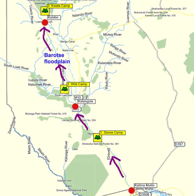
Katima to Sioma
Sioma to Wild Campsite
Wild Camp to Liuwa Plains